


Washington County (West)--Forest Grove, Cornelius Cities, Bethany & Oak Hills PUMA, Oregon
About
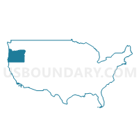
Outline
--Forest+Grove%2c+Cornelius+Cities%2c+Bethany+%26+Oak+Hills+PUMA%2c+Oregon_A280.png)
Summary
| Unique Area Identifier | 193838 |
| Name | Washington County (West)--Forest Grove, Cornelius Cities, Bethany & Oak Hills PUMA |
| State | Oregon |
| Area (square miles) | 556.37 |
| Land Area (square miles) | 554.22 |
| Water Area (square miles) | 2.15 |
| % of Land Area | 99.61 |
| % of Water Area | 0.39 |
| Latitude of the Internal Point | 45.59687490 |
| Longtitude of the Internal Point | -123.17015540 |
Maps
--Forest+Grove%2c+Cornelius+Cities%2c+Bethany+%26+Oak+Hills+PUMA in Oregon.png)
Graphs
Select a template below for downloading or customizing gragh for Washington County (West)--Forest Grove, Cornelius Cities, Bethany & Oak Hills PUMA, Oregon
--Forest+Grove%2c+Cornelius+Cities%2c+Bethany+%26+Oak+Hills+PUMA%2c+Oregon_T0.png)
--Forest+Grove%2c+Cornelius+Cities%2c+Bethany+%26+Oak+Hills+PUMA%2c+Oregon_T1.png)
--Forest+Grove%2c+Cornelius+Cities%2c+Bethany+%26+Oak+Hills+PUMA%2c+Oregon_T2.png)
--Forest+Grove%2c+Cornelius+Cities%2c+Bethany+%26+Oak+Hills+PUMA%2c+Oregon_T3.png)
--Forest+Grove%2c+Cornelius+Cities%2c+Bethany+%26+Oak+Hills+PUMA%2c+Oregon_T4.png)
--Forest+Grove%2c+Cornelius+Cities%2c+Bethany+%26+Oak+Hills+PUMA%2c+Oregon_T5.png)
--Forest+Grove%2c+Cornelius+Cities%2c+Bethany+%26+Oak+Hills+PUMA%2c+Oregon_T6.png)
--Forest+Grove%2c+Cornelius+Cities%2c+Bethany+%26+Oak+Hills+PUMA%2c+Oregon_T7.png)
--Forest+Grove%2c+Cornelius+Cities%2c+Bethany+%26+Oak+Hills+PUMA%2c+Oregon.png)
Neighbors
Neighoring Public Use Microdata Area (by Name) Neighboring Public Use Microdata Area on the Map
- Columbia, Lincoln, Clatsop & Tillamook Counties PUMA, OR
- Portland City (Northwest & Southwest) PUMA, OR
- Washington County (Central)--Beaverton City (West) & Aloha PUMA, OR
- Washington County (Central)--Hillsboro City PUMA, OR
- Washington County (Northeast)--Beaverton City (East & Central) & Cedar Mill PUMA, OR
- Yamhill & Polk Counties PUMA, OR
Top 10 Neighboring County (by Population) Neighboring County on the Map
- Multnomah County, OR (735,334)
- Washington County, OR (529,710)
- Yamhill County, OR (99,193)
- Columbia County, OR (49,351)
- Clatsop County, OR (37,039)
- Tillamook County, OR (25,250)
Top 10 Neighboring County Subdivision (by Population) Neighboring County Subdivision on the Map
- Beaverton-Hillsboro CCD, Washington County, OR (404,973)
- Portland West CCD, Multnomah County, OR (125,084)
- Rockcreek CCD, Washington County, OR (69,001)
- Newberg CCD, Yamhill County, OR (37,156)
- Forest Grove-Cornelius CCD, Washington County, OR (37,133)
- Tillamook CCD, Tillamook County, OR (11,950)
- Scappoose CCD, Columbia County, OR (9,504)
- Coast Range CCD, Washington County, OR (8,317)
- Carlton CCD, Yamhill County, OR (7,603)
- Chehalem Mountains CCD, Washington County, OR (5,486)
Top 10 Neighboring Place (by Population) Neighboring Place on the Map
- Hillsboro city, OR (91,611)
- Beaverton city, OR (89,803)
- Forest Grove city, OR (21,083)
- Bethany CDP, OR (20,646)
- Cedar Mill CDP, OR (14,546)
- Cornelius city, OR (11,869)
- Oak Hills CDP, OR (11,333)
- Rockcreek CDP, OR (9,316)
- North Plains city, OR (1,947)
- Banks city, OR (1,777)
Top 10 Neighboring Unified School District (by Population) Neighboring Unified School District on the Map
- Portland School District 1J, OR (459,982)
- Beaverton School District 48J, OR (255,082)
- Hillsboro School District 1J, OR (125,462)
- Forest Grove School District 15, OR (34,131)
- Newberg School District 29J, OR (33,940)
- Scappoose School District 1J, OR (14,486)
- Tillamook School District 9, OR (13,284)
- Neah-Kah-Nie School District 56, OR (7,654)
- Yamhill-Carlton School District 1, OR (6,748)
- Banks School District 13, OR (6,119)
Top 10 Neighboring State Legislative District Lower Chamber (by Population) Neighboring State Legislative District Lower Chamber on the Map
- State House District 33, OR (79,509)
- State House District 26, OR (76,186)
- State House District 30, OR (74,832)
- State House District 24, OR (66,002)
- State House District 29, OR (65,597)
- State House District 34, OR (65,504)
- State House District 31, OR (62,690)
- State House District 32, OR (60,293)
Top 10 Neighboring State Legislative District Upper Chamber (by Population) Neighboring State Legislative District Upper Chamber on the Map
- State Senate District 17, OR (145,013)
- State Senate District 13, OR (141,274)
- State Senate District 15, OR (140,429)
- State Senate District 12, OR (128,429)
- State Senate District 16, OR (122,983)
Top 10 Neighboring 111th Congressional District (by Population) Neighboring 111th Congressional District on the Map
- Congressional District 1, OR (802,570)
- Congressional District 3, OR (762,155)
- Congressional District 5, OR (757,128)
Top 10 Neighboring Census Tract (by Population) Neighboring Census Tract on the Map
- Census Tract 315.13, Washington County, OR (11,399)
- Census Tract 70, Multnomah County, OR (8,181)
- Census Tract 9604, Tillamook County, OR (7,664)
- Census Tract 322, Washington County, OR (7,645)
- Census Tract 304, Yamhill County, OR (7,603)
- Census Tract 329.02, Washington County, OR (7,568)
- Census Tract 315.12, Washington County, OR (7,535)
- Census Tract 315.08, Washington County, OR (7,507)
- Census Tract 316.10, Washington County, OR (7,458)
- Census Tract 316.11, Washington County, OR (7,147)
Top 10 Neighboring 5-Digit ZIP Code Tabulation Area (by Population) Neighboring 5-Digit ZIP Code Tabulation Area on the Map
- 97006, OR (63,036)
- 97229, OR (58,217)
- 97124, OR (48,349)
- 97123, OR (44,537)
- 97005, OR (24,906)
- 97116, OR (24,104)
- 97113, OR (14,155)
- 97056, OR (11,497)
- 97106, OR (4,550)
- 97119, OR (4,420)